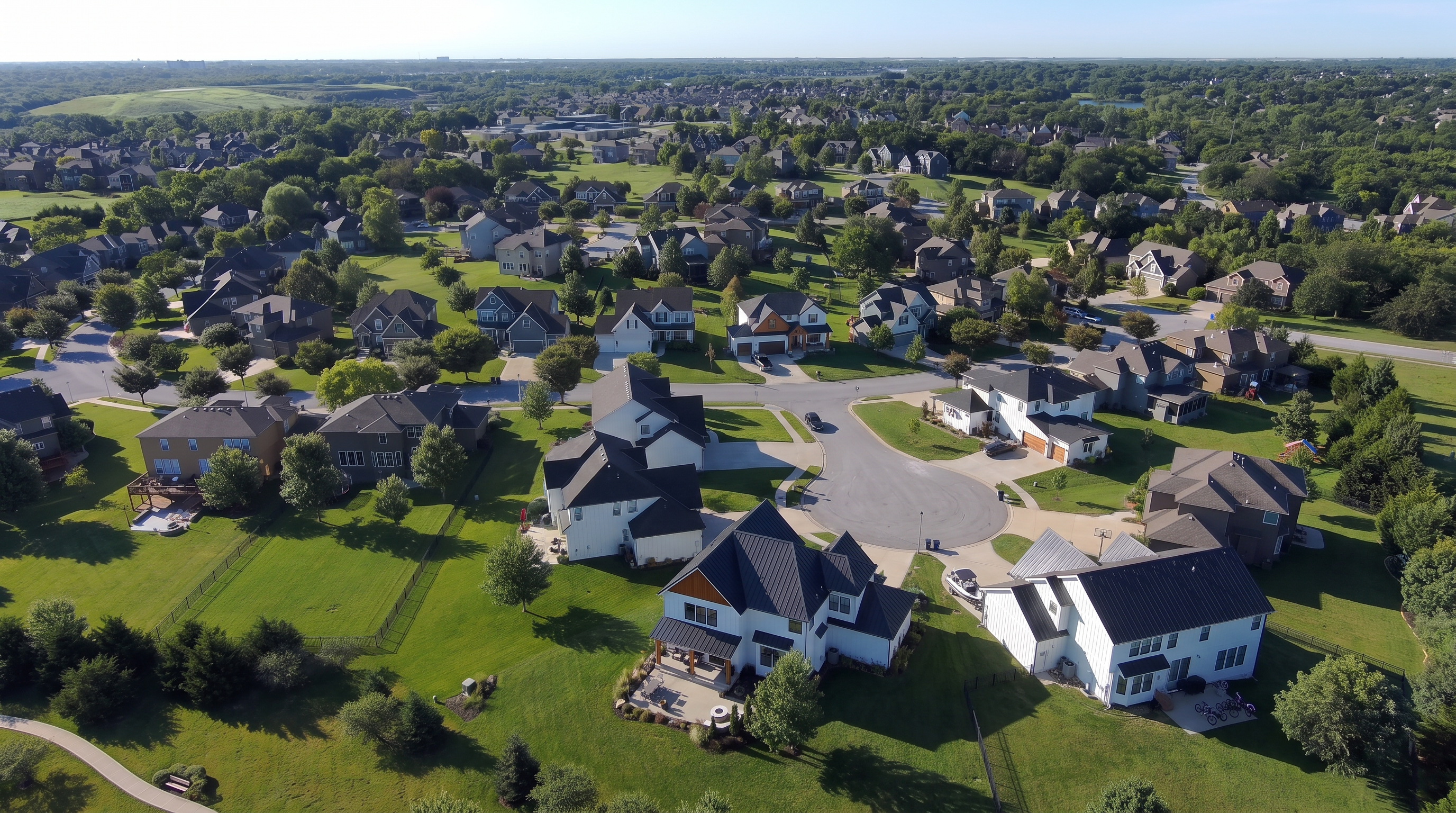
Buyers want a sense of how a property fits into its neighborhood and surroundings, but ground photos can't show the full picture here. To get an aerial for your listing, your options are to hire a certified pilot, earn your own Part 107 certificate or generate the shot with AI. Each one is right for a different job, but it's important to understand the limitations and liability when it comes to real estate aerial photography.
The decision rule
The main question that defines what method of aerial photography you'll need is:
Does a buyer need to rely on what this shot shows?
If the answer is yes, you'll need to fly it. A frame that establishes lot size, property boundaries, roof condition or distance to the water has to be real footage of the real property, captured by a real aircraft. Real flight records the property, and that record carries evidentiary weight if anyone questions what the listing showed.
If the answer is no, then generate it. Golden hour skies, an establishing shot of the coastline, a seasonal mood piece for a Reel: if no one will base their decision to buy the house on that frame, then no aircraft has to leave the ground for you to have it. AI drone video can give you style and atmosphere to set the stage of the property.
What an aerial does for a listing
Drone video for real estate listings answers the questions buyers ask before they ever book a showing. How large is the lot? Where do the lot lines run? What sits next door? How close are the water, the park and the schools?
A majority of the value is in specific property types. Acreage and rural estates, waterfront homes, luxury listings, properties with pools or docks or large grounds, new construction and any home where the location is a major selling point. A standard condo interior gains almost nothing from aerial work. A five-acre parcel with a pond listing, however, needs drone footage to be complete.
Aerial photos and video do different jobs. A still frame proves the yard exists, while a slow orbit shows how big it is, how private it is from the neighbors and where it sits relative to the house. Most real estate drone videography packages offer both: 5 to 10 aerial stills for the MLS gallery and the virtual tour, plus a 60- to 90-second real estate aerial video for social media, the property page and email.
Drone photography and video is the third most-adopted technology among agents at 52%, while 88% have never tried AR or VR.
Three Routes: Hire, Certify or Generate
| Hire a certified pilot | Get certified yourself | Generate with AI | |
|---|---|---|---|
| Best for | Fewer than 10 aerial listings a year, one-off luxury shoots | High-volume agents and teams, photographers adding aerial services | Atmosphere and context, pre-flight planning, restricted airspace, tight budgets |
| Cost | Roughly $100 for basic aerial photography up to several thousand for packages (Zillow). HomeJab publishes $249 for 10 HDR aerial images, $269 for a 60- to 90-second cinematic aerial video and $319 for both. | On average: $175 knowledge test fee, $300 to $1,000 for a drone, $5 to register it for three years | Free tiers available, included in subscriptions |
| Time to first asset | 24 to 72 hours after the flight, weather permitting | 15 to 20 hours of study before your first legal flight | Minutes |
| Legal burden | None. The pilot holds Part 107 and handles airspace. | Yours. You hold the certificate and run every airspace check. | No FAA involvement. Disclosure rules apply instead. |
| Cannot do | Depends on HOA and property rules, can't fly in restricted airspace. | Depends on HOA and property rules, can't fly in restricted airspace. | Show your actual property as a matter of record |
Most successful programs use two of the three, optimizing for value and ease. Hire for the listings that sell on land and location, generate for the atmosphere shots that fill out a reel.
The eight shots
Whether you are briefing a pilot or writing prompts, these are the moves that make up a listing video.
- Establishing shot. Fly slowly toward the home from beyond the property to set the location.
- The reveal. Start low and close, facing away from the house, then climb and tilt down until the full property fills the frame.
- Front facade hero. A straight-on or angled view from 15 to 25 feet up. Also known as the curb appeal shot.
- Orbit. Circle the home or the pool at medium height, showing the roofline, the grounds and the outdoor space in one move, with foreground trees passing through the frame for parallax.
- Top-down (nadir). Camera straight down, showing lot lines, the driveway, outbuildings and the full property boundaries.
- Backyard and lot pass. A controlled pass over the pool, patio, dock or garden.
- Neighborhood context. Climb high and look outward in two or three directions at the park, the school, the water or the skyline. Never imply a view or a distance the property lacks.
- Closing pull-out. Rise and back away slowly, ending on the property within its surroundings.
For luxury listings, an FPV (first-person view) drone video adds a shot a standard aerial cannot: a small drone flown from the patio, through the doors and into the living areas in one continuous take. It is also a two-person job. The pilot is flying in goggles, so FAA rules require a visual observer to keep the drone in unaided sight throughout the flight. That crew requirement is most of why FPV prices sit above a standard aerial package, and it is the reason to book a specialist rather than add FPV to an existing shoot. No generated clip qualifies as an FPV clip, the movement of the drone defines this type of shot.
Camera settings
Shoot 4K to keep cropping headroom in post-production, at 24fps for a cinematic look or 60fps for anything you plan to slow down. Lock exposure and white balance with AE-L before each take, since an auto settings shift mid-flight wrecks color consistency between clips. Confirm gimbal stabilization is active and level.
Real estate aerial videography rewards long, slow, continuous moves. Hold each one for 5 to 10 seconds and keep only the best few. Golden hour gives you the strongest exterior light and twilight looks striking on luxury listings, though always check HOA rules on what time flights are allowed.
Route 1: Hire a certified pilot
The pilot carries the certificate, the insurance and the airspace responsibility. Your job is the brief and the contract.
The National Association of REALTORS® publishes a hiring checklist that covers the main points you need to know before signing a contract.
- Verify the Remote Pilot Certificate. Ask for the number and proof of current recurrent training.
- Verify liability insurance. Request a certificate of insurance naming your brokerage. One million dollars in aviation coverage is the standard ask.
- Settle copyright ownership in writing. Written copyright assignment lets you reuse the footage across the MLS, social media and paid ads without going back for permission.
- Check for indemnification language protecting you if the pilot violates airspace rules.
- Get the deliverables list in writing: file formats, number of stills, video length and raw footage versus edited cut. Raw files cost extra with some providers.
- Confirm turnaround time and the weather reschedule policy. A 24-hour turnaround costs more than 72.
Most real estate drone video services bundle aerial stills, an edited video and sometimes floor plans or a virtual tour. Bundles cost less than booking each piece alone. When you compare real estate drone video pricing across providers, compare what is inside the bundle rather than the headline number.
Route 2: Get Part 107 certified
Drone real estate marketing in the United States runs under FAA Part 107, and these common misconceptions can result in major trouble down the line:
"I'm not charging for the flight, so I don't need Part 107." The FAA looks at purpose, not payment. Any flight conducted to further a business is a commercial operation. An agent filming their own listing for free is operating commercially.
"My drone weighs under 250 grams, so the rules don't apply." The sub-250g exception is a registration exception for recreational flyers, not an exemption from Part 107. Real estate work is commercial regardless of aircraft weight, and every drone flown under Part 107 has to be registered.
Getting certified
The FAA has a fixed process for certification. You need to be at least 16, able to read, speak, write and understand English, and in a physical and mental condition to fly safely. Get an FAA Tracking Number through IACRA before you schedule anything. Studying for the Unmanned Aircraft General – Small knowledge test takes most people 15 to 20 hours. Sit the test at an FAA-approved testing center, where the fee is $175 per attempt, paid to PSI Services. File Form 8710-13, clear TSA vetting and register the aircraft through FAADroneZone for $5, valid three years. Recurrent training every 24 calendar months keeps you current, and it is free and online.
Before every flight
- Check the airspace. Controlled airspace near an airport requires authorization, and most pilots request it through LAANC, which returns near-instant approvals in many zones.
- Stay within visual line of sight.
- Stay at or below 400 feet AGL, under 100 mph, with an aircraft under 55 lbs.
- Confirm Remote ID compliance.
- Check state, city and HOA rules on takeoff and landing. The owner's permission for the yard does not authorize the airspace above it.
- Carry liability insurance.
The breakeven math
The typical agent closed nine transaction sides in 2025 (NAR 2026 Member Profile). Set the $175 test fee and a $1,000 drone against $249 to $319 per hired shoot and the arithmetic is not close: certification pays for itself somewhere between the third and the fifth listing. Certify if aerials are a standing part of how you market. Hire if they are occasional, because a certificate you never exercise is a skill that decays.
Route 3: Generate the aerial shots
AI drone video produces aerial-style motion without an aircraft. You describe the shot and the model renders it. No pilot, no Part 107, no airspace authorization, no weather delay.
Three jobs suit it well:
- Atmosphere and context, where the frame sets a mood rather than proving a fact.
- Pre-flight planning, where you storyboard the exact shots you want and hand the reference clips to the pilot before you pay for a flight.
- Restricted situations, where approvals stall in controlled airspace or the budget will not cover a shoot and your marketing still has to go out on schedule.
Start from a real listing photo wherever you have one. Image-to-video output holds the property accurate in a way that text-only prompting does not. Our photo to video tips and the AI video prompting guide cover the mechanics, and the camera angle and shot type guide maps the moves below to prompt language.
The reveal
- A slow aerial climb above a suburban home at golden hour. The camera rises and tilts down. The full lot and surroundings come into view. Smooth motion, cinematic light, 4K.
Orbit (parallax)
- A steady aerial orbit around a modern house with a pool. Medium height, smooth circular motion, warm evening light, trees passing through the frame for parallax.
Push-in
- A slow aerial push toward a waterfront home, moving past foreground trees. The house grows in the frame. Soft morning light, calm water below.
Pull-out
- A slow aerial pull-out from a luxury home. The camera rises and backs away. Rooftops and streets fill the frame around the property.
Top-down (nadir)
- A vertical aerial view of a residential lot, descending slowly. Driveway, pool and boundaries stay centered. Clean midday light, minimal shadows.
Fix the lighting on a draft with the relight scene app and finish with upscaling the video before anything goes on a property page. An AI video generator runs all five.
When you can't use generated aerial shots
As expected, there are certain limits to be aware of when using generated shots:
- They cannot document your property. Even starting from real listing photos, the model interprets rather than records. A generated frame isn't the same as real footage of your property.
- They cannot support a claim about lot size, boundaries, setbacks, roof condition or distance to an amenity. Those are the shots you fly.
- They cannot replace an FPV flythrough. FPV is a piloted discipline with a look that comes from the flying.
- They cannot be used without being disclosed as AI. See the checklist below.
- They cannot add a view, a waterfront, a treeline or a neighbor the property does not have. That is misrepresentation, not styling.
You cannot buy stock footage of specific property
Stock works to establish an atmosphere in certain categories. A coastline, a suburban grid at dusk, a mountain treeline: buy the license, check that it covers commercial use and cut it into the reel as scenery.
Stock cannot do the one thing a listing video exists to do, which is show a specific home. No library has footage of your property, and no license makes a stranger's rooftop into your client's. Generating your aerials from existing listing photos gives you the ease of stock photography while still keeping your listing advertisements consistent and specific.
Disclosure checklist
- Label AI-generated and AI-altered imagery in the listing and on social posts.
- Never present generated or stock footage as the actual property.
- Never add views, water or amenities the property lacks.
- Check your MLS AI disclosure rules before publishing.
- Review each stock clip's license for commercial use.
- Get written client approval for generated content before the listing goes live.
California has the most stringent requirements. AB 723 added Business and Professions Code § 10140.8 effective January 1, 2026, requiring a disclosure statement plus a link, URL or QR code to the original unaltered image whenever software or AI has added, removed or changed elements in a listing image. Straightforward corrections such as lighting, white balance, sharpening, cropping and exposure are excluded. The statute's text addresses images and does not mention video, film or moving images, which leaves aerial video in genuinely unsettled territory rather than safe territory.
Editing, length and recutting
Cut aerial clips every 3 to 5 seconds. Use licensed music only, because unlicensed tracks expose you and your brokerage to copyright claims. Simple on-screen labels provide context for the viewer: "1.2-acre lot," "walk to waterfront," "heated pool." Apply gentle color correction in post-production and skip heavy filters. Instead, focus on matching the same light quality and atmosphere in your listing photos for cohesive listing visuals that leave the buyer confident about the property.
One aerial sequence should feed every channel:
| Destination | Length | How to build the aerial shot |
|---|---|---|
| Reels, Shorts, TikTok | 30 to 60 seconds | First three shots only, vertical crop, hook on the reveal |
| MLS and property page | 90 to 120 seconds | Full aerial sequence with an interior walkthrough cut in after the orbit |
| Email and paid social | 15 to 30 seconds | Establishing shot and closing pull-out, contact card on the end frame |
A working template for the aerial segment:
- 0:00–0:05 establishing shot, neighborhood approach.
- 0:05–0:12 the reveal, climb over the property.
- 0:12–0:20 orbit around the home.
- 0:20–0:27 top-down lot view.
- 0:27–0:35 feature shots: pool, patio, dock.
- 0:35–0:42 neighborhood context.
- 0:42–0:50 closing pull-out with agent contact card.
Aerials sell the setting while interiors sell the house, so a complete listing video needs both.
Frequently asked questions
Do I need a license to use drone footage in my listings?
Yes, in the United States. Listing promotion counts as a commercial operation under FAA Part 107, and the pilot needs a Remote Pilot Certificate. This holds even when nobody pays for the flight.
Do I need a Part 107 if I am not charging?
Yes. The FAA looks at purpose, not payment. Any flight conducted to further a business is commercial, so an unpaid flight for your own listing still requires Part 107.
Is it worth getting my own drone license?
For agents running aerials on most of their listings, yes. The test fee is $175 and study runs 15 to 20 hours, which the typical agent recovers in three to five hired shoots. Below that volume, hiring is cheaper and simpler.
How much does a real estate drone video cost?
Published rates run from about $100 for basic aerial photography to several thousand for full packages. HomeJab, a national provider, lists $249 for 10 HDR aerial images, $269 for a 60- to 90-second cinematic video and $319 for both. Luxury properties and FPV flythroughs run higher, and teams booking monthly usually negotiate volume rates.
Can I get aerial shots without a drone?
Three different ways: License stock footage for neighborhood context, hire a certified pilot or generate aerial-style motion with AI from your own listing photos. Each route carries different disclosure obligations.
Can I use stock drone footage for a listing?
For neighborhood and lifestyle context, yes. Pixabay and Pexels offer free clips, and Shutterstock, Pond5, Adobe Stock and Storyblocks sell them. Review each license for commercial use, and never present stock as the actual property.
Is it legal to use an AI-generated aerial in a listing?
FAA rules do not apply because no aircraft flies. Contract, MLS and disclosure rules still apply. Label generated content, never fake the property and check your MLS policy first. California listings fall under AB 723 for altered images.
Can I fly a drone near an airport?
Only with airspace authorization. Controlled airspace requires approval, and most pilots request it through LAANC, which returns near-instant decisions in many zones. A flight without authorization is a violation regardless of altitude.
Can I fly over my neighbor's property?
Part 107 does not prohibit overflight, but state privacy law, local ordinances and HOA rules may. Takeoff and landing need the landowner's permission, and always avoid pointing a camera into a neighbor's yard.
Why did my drone shoot get cancelled?
Wind, rain, low cloud, a denied airspace authorization or a temporary flight restriction. Weather scrubs are common enough that a reschedule policy belongs in the contract, and they are the main reason to have generated context footage on hand.
What is the best drone for real estate?
Any current consumer drone with a stabilized gimbal and 4K capture handles listing work. Spend the difference on obstacle avoidance and battery life rather than sensor size, and register whatever you buy.
How long should a real estate drone video be?
30 to 60 seconds for social platforms and 90 to 120 seconds for the MLS and property pages. Cut clips every 3 to 5 seconds regardless of total runtime.
Fly the shots a buyer may base a decision on, generate the ones that set a mood. Keep that mood consistent across all your listing visuals (and portfolio) to make the biggest impact. Learn more about how agents are using generated video across their listings or get started today with Runway.